WIRIS Pro
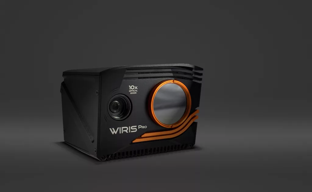
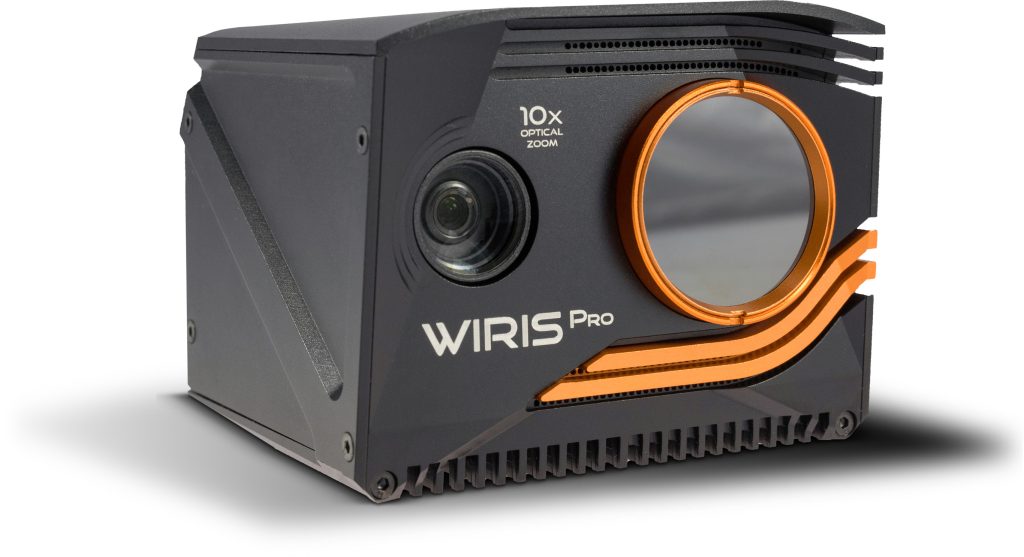
The Workswell WIRIS® Pro is a specially designed thermodiagnostic device. Its thermal camera is equipped with an LWIR microbolometric sensor with 640×512 px resolution (in the 7.5 – 13.5 μm range), and its 'Super Resolution Mode' functionality delivers a final thermogram in 1266x1010 px resolution. The RGB camera comes with Full HD (1920 x 1080 px) resolution and provides an absolutely unrivalled optical ultrazoom – as much as 10x (6.9° to 58.2° field of vision). The highest possible temperature that the thermal camera can measure is 1,500 °C.
Thermal imaging camera
WIRIS Pro is an advanced thermal imaging camera developed by Workswell, a leading provider of thermal imaging solutions. This high-performance camera is designed to capture accurate and detailed thermal images for a wide range of applications, from building diagnostics and industrial inspections to research and development.
Equipped with state-of-the-art features such as a high-resolution sensor, multiple lenses, and advanced image processing algorithms, WIRIS Pro delivers exceptional image quality and thermal sensitivity. It also offers a range of measurement tools and features for advanced analysis, including temperature measurement, radiometry, and advanced reporting capabilities.
WIRIS Pro is a versatile and reliable thermal imaging camera and solution, that can help professionals in various industries to detect and diagnose issues quickly and accurately. With its robust design and advanced features, it is an ideal tool for anyone looking to improve their thermal imaging capabilities and streamline their workflow.



Inspection and Mapping
The WIRIS Pro thermal imaging camera is a versatile device that can be used for both inspection and mapping purposes. It utilizes infrared technology to detect and measure the temperature of objects and surfaces, and can produce high-resolution thermal images and videos.
For inspection purposes, the thermal imaging camera can be used to detect and locate thermal anomalies in a wide range of applications, including electrical, mechanical, and building inspections. The camera can identify overheating components, energy losses, and other potential problems that are not visible to the naked eye.
For mapping purposes, the camera can be used to create thermal maps of large areas, such as industrial plants, solar farms, or agricultural fields. The camera can capture thermal data over a wide range of temperatures and can create high-resolution thermal images that can be used to identify temperature variations and patterns over time.
Weight and Dimensions
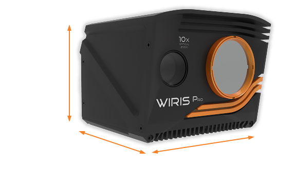
Workswell's WIRIS® weighs less than 430 g, which makes it very convenient for drone use.
WEIGHT: < 430 g (0.95 lb)
DIMENSIONS : 83 x 85 x 68 mm (3.26 in x 3.34 in x 2.67 in)
High Resolution and Thermal Sensitivity
Our thermal imaging camera is equipped with an LWIR microbolometric sensor with 640x512 px resolution and Super Resolution Mode functionality, which facilitates the creation of a final thermogram at 1266 x 1010 px resolution. The standard WIRIS Pro delivers 50 mK temperature sensitivity, and we offer a 30 mK premium version.
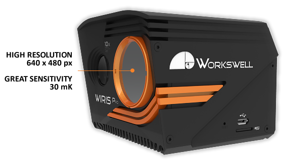
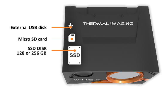
128 GB or 256 SSD Disk, External USB Disk or microSD Card
Workswell WIRIS® Pro camera is equipped with an internal SSD disc with 128 GB or 256 GB memory for recording. You can also save data to an external USB disk or microSD card.
Precision Metrology
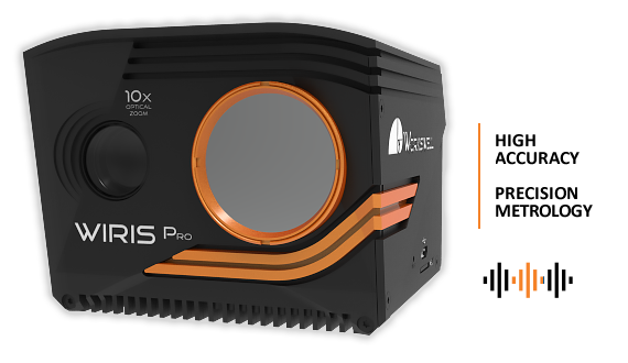
We know that industrial applications present a serious challenge to metrological endeavors. To ensure the accuracy of our devices in the face of this challenge, we calibrate each of our lenses individually. Our thermal imaging camera WIRIS Pro and also all cameras are individually manufactured and precisely calibrated, and we deliver a final calibration certificate along with each unit.
Durable Design
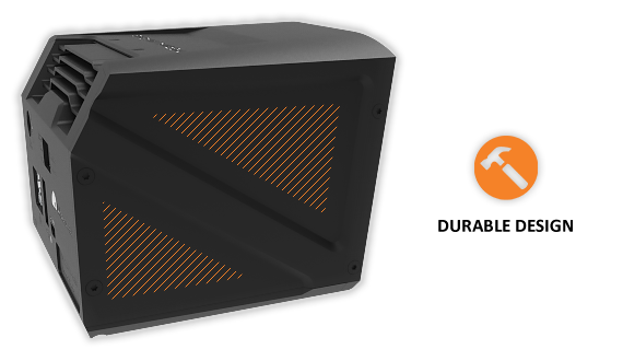
The WIRIS® Pro is ensconced a rugged casing of lightweight aluminum. In addition, its most sensitive part, the thermal camera lens, is protected by a replaceable protective cap made of germanium.
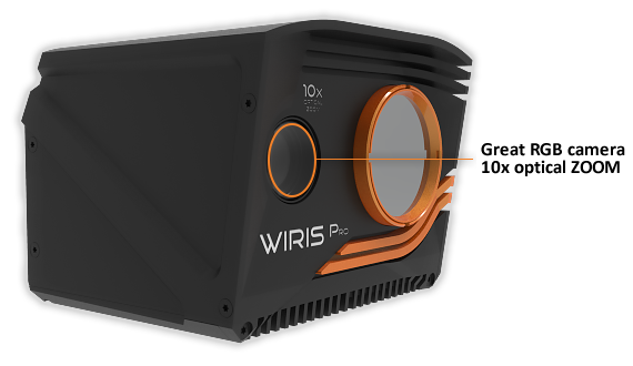
Precise RGB Camera with Optical 10x ZOOM for Inspections
The WIRIS Pro’s RGB camera comes with Full HD (1920 x 1080 px) resolution and, most importantly, it provides an absolutely unrivalled optic ultrazoom – up to 10x (6.9° to 58.2° field of vision). ZOOM is fully synchronous with the thermal camera and makes for an advanced inspection tool.
Video Streaming and Commands via WiFi
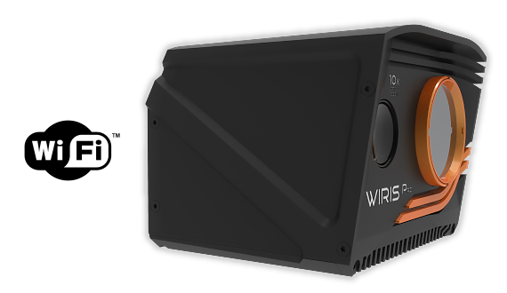
RTSP video streaming, image and command transfer through Wi-Fi add to the WIRIS OS functionalities. These features are provided by the RJ 45 Ethernet port.
See more information in our Stream SDK tutorial.
WIRIS OS - Capture the Potential
WIRIS OS has been in continuous development for over 4 years, and it has been tested on previous generations of Workswell WIRIS® cameras. Today, WIRIS OS allows you to capture the full potential of the camera’s sensor and computing hardware, and thus enjoy functionalities which similar products without an operating system cannot even come close to.
SDK - your own applications
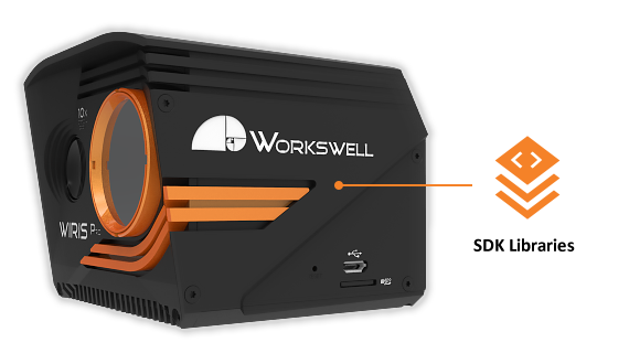
We provide an SDK (Standard Development Kit) with every Workswell WIRIS® Pro to enable you to develop your own applications. These libraries give access to low-level functionalities and enable the application developer to maximize the potential of the camera’s hardware.
See more information in Data SDK tutorial
HW communication, control ports & interfaces
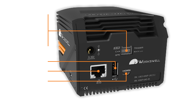
Workswell's WIRIS® Pro also offers an interface enabling the widest range of connections to the drone, the control unit, an external GPS sensor, and other devices. A Wi-Fi low latency live video streaming and command link is also available. The following HW interfaces are on offer:
S.BUS
CAN bus (DJI M600 and A3 controller compatible)
Ethernet (RJ 45 with RTPS streaming and control signals transmission option)
MavLink – Provides a wide range of standard and custom commands for controlling the thermal camera during the flight.
External GPS connection
External trigger
CANbus & UART serial communication
Picture in Picture Functionality
The innovative picture-in-picture feature allows you to merge a thermal image with an RGB camera image in real-time, even with 10x optical ZOOM.
Thermal and Visual Comparison


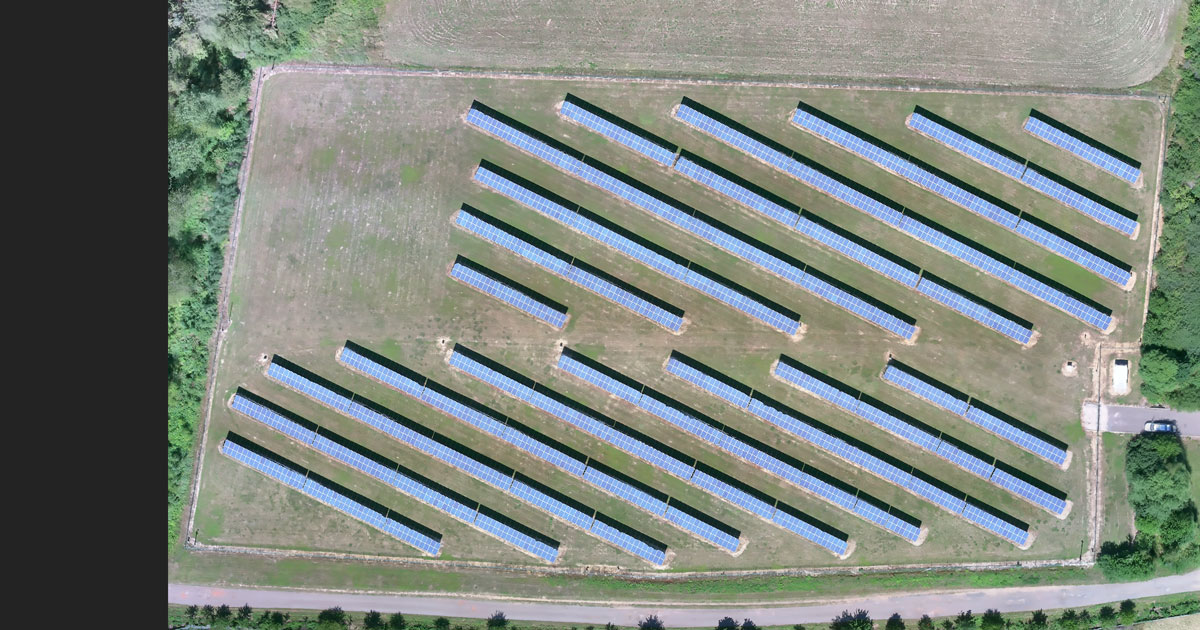
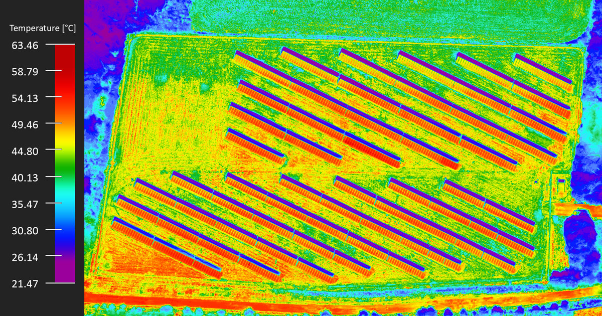
See in full resolution
Related applications
From power engeneering and power plants to building and pipeline inspetions
Details are important
Thermolab is a software for detailed analysis of thermograms from thermal and infrared cameras, allowing the user to edit the data into different formats and create clear reports from the thermograms. All standard data analysis functions are available in the program (temperature at a point, minimum and maximum of the area, temperature profile, zoom, temperature scale change, color palette, emissivity, etc.) as well as extended functions such as GPS location of the image and the ability to display RGB digital images.
WIRIS OS
WIRIS OS has been in continuous development for over 4 years, and it has been tested on previous generations of Workswell WIRIS® cameras.
Today, WIRIS OS allows you to capture the full potential of the camera's sensor and computing hardware, and thus enjoy functionalities which similar products without an operating system cannot even come close to.
Gallery
Do you have any questions?
Please don’t hesitate to contact me if you need further information.
Video
Other information
| WIRIS Pro Key features description | |
| Super Resolution Mode | WIRIS Pro takes Super Resolution Mode 1.3Mpx IR images in one shot |
| Operating onboard system | WIRIS OS for full real-time data streaming and control during the flight
|
| 10x Optical Antivibration zoom | Full HD 10x optical zoom camera with anti-vibration compensation |
| Thermal camera specification | |
| IR camera resolution | 640 x 512 pixels |
| IR Super Resolution Mode | 1 266 x 1 010 pixels (improvement of native resolution up to 1.3 Mpx) |
| FPA active sensor size | 1.088 x 0.8705 cm |
| Temperature ranges | -25 °C to +150 °C (-13 °F to 302 °F) -40 °C to +550 °C (-40 °F to 1 022 °F) optional temperature range 50 °C to 1 000 °C (122 °F to 1 832 °F) optional temperature range 400 °C to 1 500 °C (752 °F to 2 732 °F) |
| Temperature sensitivity | Standard 0.05 °C (50 mK) or optional 0.03 °C (30 mK) |
| Accuracy | ±2 % or ±2 °C |
| Frame rate | 30 Hz or 9 Hz |
| Spectral range / detector | 7.5 – 13.5 μm / Uncooled VOx microbolometer |
| Calibration of each lens | Package includes a calibration certificate |
| Available lenses | 18°, 32°, 45°, 69° (exchangeable lenses, all calibrated), visit FOV calculator |
| Protective filter on lens | Filter protects the lens against external damage during the flight |
| Digital zoom | 1 – 14x continuous |
| Digital visual camera | |
| Resolution | 1 920 x 1 080 pixels (Full HD), 1/3” sensor, Auto white balance, Wide dynamic range, Backlight compensation, Exposure and Gamma control |
| Optical zoom | 10x optical zoom with vibration compensation |
| View angle | ultra zoom 6.9° – extra wide 58.2°, focal 33.0 mm – 3.3 mm |
| Noise reduction | Special 3D noise reduction function |
| Focus | Autofocus with Direct Focus Zoom synchronization |
| Memory and data recording | |
| Memory | Internal high-speed SSD 128GB or 256GB for image and video recording External slot for Micro SD card & USB 2.0 for USB stick for taking images |
| Image and video formats | Radiometric JPEG images and Digital camera Full HD JPEG images Radiometric TIFF images (Pix4D and Agisoft compatible for 3D modeling) Digital camera h.264 encode video HD recording Radiometric full-frame IR recording (raw data recording in 30 Hz) |
| GPS geo-tagging (image & video) | |
| GPS tagging (image & video) | MavLink or External GPS or DJI A3 controllers compatible via CAN bus |
| Interfaces & real-time remote control | |
| 10-pin digital port | S.Bus CAN bus (compatible with DJI M600 and A3 controllers) MavLink External GPS connectivity External trigger CANbus & UART |


